We remain fully operational. Our teams are working around the clock to ensure your deliveries continue safely.

Descargar la aplicación


Servicios al cliente
Sobre nosotros
Copyright © 2025 Desertcart Holdings Limited
Descargar la aplicación


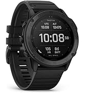
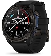
🧭 Navigate Boldly, Explore Limitlessly!
The GARMIN eTrex 22x is a rugged handheld GPS device featuring a 2.2-inch sunlight-readable color display with 240x320 resolution, dual GPS and GLONASS satellite support for enhanced positioning accuracy, and up to 25 hours of battery life powered by 2 AA batteries. With 8 GB of internal memory and expandable storage via microSD, it supports detailed TopoActive maps for reliable navigation on all your outdoor adventures.


| ASIN | B07RTD2PMT |
| Additional Features | GPS and GLONASS Satellite Service, Road-Routable TopoActive Maps |
| Are Batteries Included | No |
| Battery Average Life | 25 Hours |
| Best Sellers Rank | #28,609 in Electronics ( See Top 100 in Electronics ) #822 in Smartwatches |
| Brand | Garmin |
| Built-In Media | eTrex 22x; USB Cable; Documentation |
| Compatible Devices | Compatible with Garmin Oregon, GPSMAP 62, GPSMAP 64,GPSMAP 66 eTrex 10/20/30, Astro 320, Dakota, Colorado, inReach and Rino Series of GPS units. |
| Compatible with Vehicle Type | ATV, Car, RV |
| Connectivity Technology | USB |
| Control Method | Touch |
| Country of Origin | Taiwan |
| Customer Reviews | 4.3 4.3 out of 5 stars (1,968) |
| Display Type | LCD |
| Human-Interface Input | Buttons |
| Item Dimensions L x W x H | 5.3L x 3.3W x 10.2H centimeters |
| Item Type Name | Handheld GPS |
| Item Weight | 0.31 Pounds |
| Manufacturer | GARMIN |
| Map Types | Topographical |
| Memory Storage Capacity | 8 GB |
| Model Name | eTrex 32x |
| Model Year | 2020 |
| Mounting Type | Handlebar Mount |
| Resolution | 240 x 320 |
| Screen Size | 2.2 Inches |
| Sport Type | Camping & Hiking |
| Supported Satellite Navigation System | GLONASS |
| Touch Screen Type | Resistive |
| UPC | 753759230777 |
| Unit Count | 1 Count |
G**N
Bush walking
若**孝
日本語の説明書や本体の表示が全く理解出来なく、返信して何か騙されてお金を取られた気持ちですね。凄く残念です。
B**F
good , compact, reliable and pretty basic and easy to use
J**N
This german device is very helpful for my profession. Because i am a land surveyor so so much easier to survey the land
B**E
Perfect! Exactly what we needed. Glad we purchased this unit and not a Chinese knock-off. This one is more expensive, but this is a well spent money. Most of the cost goes into a well honed software. The software is good. It performs as expected. At least for what we need. i.e: waypoints, tracks and area calculation. We use it as a track recording device and then we import the recordings and process them on a PC. We also prepare tracks on the PC, import them in the device and march them once in the field. The ability to see our current position relative to a programmed track is nice. The screen is a bit small for my aging eyes. This is not a product issue. We understand that something to be used during hiking must be small and light. Bigger is not better. Beside that a bigger screen would be very taxing on the batteries. We used the device for a few hours and the two AA alkaline batteries are still full. The color LCD screen is transflectif giving an excellent readability in full sun (which requires less back light which in turn requires less energy, hence more autonomy to the batteries). The manufacturer states an accuracy of 4 meters. When we stand still for an extended period of time, we can see our position randomly jumping around a point. Given enough time, it is possible to assume that the average position is quite accurate. For our needs, 4 meters is enough. Overall it is an excellent product. We did not test all functions.
Trustpilot
Hace 2 semanas
Hace 1 mes